Category:KARS & KRG
Protected: Committee Meeting Minutes
Add to Committee Meeting Minutes
Members and Committee Members or Event Coordinator only
Committee Meeting Agenda
Private
all email
KARS Events widgets
Committee Meeting Agenda
Committee Meeting Agenda
RAYNET Email addresses (JZM)
Members and Committee Members or Event Coordinator only
Testing Page 2

No post found
Mileage clam form for 2026
Private
Foundation, Advance & Full Licence
The RSGB’s “Advance, the Full Licence” book comprehensively prepares candidates for the Full License examination.
| LICENCE | Max. Power |
General Limitations |
| FOUNDATION | 50w | HF (160m to 10m), VHF (2m) and UHF (70cm) Commercially made equipment only UK Only |
| INTERMEDIATE | 100w | All UK Amateur Frequencies Can build / Repair equipment from kits or published plans UK Only |
| FULL | 1KW | All UK Amateur Frequencies Can build / Repair equipment from scratch Can operate abroad where reciprocal agreements exist Can operate Maritime Mobile with permission of the Ship’s Master. |
At first, Amateur Radio Station call signs appear to comprise a semi-random collection of letters and numbers, but there is some logic involved (although they’re not as simple to understand as the generally accepted and used FreeBand call signs). The first letter (nearly always) identifies the country in which the licence was issued, and the remaining letters and numbers identify the individual that holds the licence, and perhaps some information about the level of licence held.
| LICENCE | Current Typical Format | Meaning / Historical | Examples |
| FOUNDATION | M6abc | “M” indicates a UK Licence, “6” indicates the licence is Foundation level “abc” are the individual’s unique identification letters Previous to “M6” Licenses, Foundation holders were issued “M3”. There is no difference in the two, the change to M6 was simply made because the majority of M3 call-signs had been used. |
M6MAD, M6ERG, M3CDE, MD4CAT |
| INTERMEDIATE | 2x0abc | “2×0” indicates a UK Intermediate Licence), “x” is the Regional Identifier (see below) “abc” are the individual’s unique identification letters | 2E0QWE, 2W0DAI, 2M0MCC |
| FULL | M0abc | “M” indicates a UK Licence, “0” indicates the licence is Full level “abc” are the individual’s unique identification letters Previous to “M0” Licenses, all UK Class 1 and Class 2 Licenses were prefixed “G”. Before the Morse requirement was lifted the last digit usually indicated a Class 1 or Class 2 licence determining whether the licence holder had completed the mandatory Morse Speed Test and could use HF frequencies, or was limited to VHF and above. Now all “G” licenses and “M0” have exactly the same privileges. |
M0SDY, M0DAN, MI0MIL |
A Summary of UK Callsigns follows:
| Call sign | Issue dates and details |
| G2 + 2 letters | 1920 – 1939 |
| G3 + 2 letters | 1937 – 1938 |
| G4 + 2 letters | 1938 – 1939 |
| G5 + 2 letters | 1921 – 1939 |
| G6 + 2 letters | 1921 – 1939 |
| G8 + 2 letters | 1936 – 1937 |
| G1 + 3 letters | 1983 – 1988 – originally issued as Class B licence |
| G2 + 3 letters | Originally issued as “Artificial Aerial” licence |
| G2 + 3 letters | Originally issued as “Artificial Aerial” licence |
| G3 + 3 letters | Issued between 1946 and 1971. Originally issued to amateur radio Class A licence holders |
| G4 + 3 letters | Issued between 1971 and 1985. Originally issued to amateur radio class A licence holders. |
| G5 + 3 letters | Originally issued to foreign nationals as a form of reciprocal ham radio licence. They were withdrawn and either they used existing home calls with additional UK prefix / callsign, or if applicable they could apply for UK licence. |
| G6 + 3 letters | 1981 – 1983. Originally issued as a class B licence |
| G7 + 3 letters | 1989 – 1996. Originally issued as a class B licence |
| G8 + 3 letters | 1964 – 1981. Originally issued as a class B licence |
| G0 + 3 letters | 1986 – 1996. Originally issued as a class A licence |
| M1 + 3 letters | 1996 – . Originally issued as a class B licence. |
| M0 + 3 letters | 1996 – . Originally issued as a class A licence |
| M3 + 3 letters | Foundation licence. |
| M6 + 3 letters | Foundation licence, from May 2008. |
UK Amateur Licenses also include a Mandatory Prefix and an optional (but recommended Best Practice) Suffix when used.
| PREFIX | SUFFIX |
| PURPOSE: – The Prefix Letter indicates from which Country within the United Kingdom the Radio is currently being operated. If no Prefix is shown it is assumed to be operating in the Default Country, England. However, for Intermediate licenses (only) the “E” is required (eg 2E0MLN). | MEANING: – Inclusion of the Suffix letters used to be Mandatory but is now optional (although Recommended). The letter(s) indicate the type of location from which the station is transmitting. |
POSSIBLE PREFIX LETTERS:
|
POSSIBLE SUFFIX LETTERS:
|
| PREFIX EXAMPLES:
|
SUFFIX EXAMPLES:
|
Coordinator and Engineer needed Members Area
Hi,
We will need members to coordinate and engineer the following events for 2026. If you think you are up to the challenge and would like to try please contact Geoff G7JZM or Mike G7HEN
We will need members to coordinate and engineer the following events for 2026. If you think you are up to the challenge and would like to try please contact Geoff G7JZM or Mike G7HEN
RAYNET Email addresses
Members and Committee Members or Event Coordinator only
Protected: Testing Page (Leeeds)
Mileage Clams 2026 (Admin)
Members and Committee Members or Event Coordinator only
Protected: Please fill in the clam for for 2026 Enter your password is your Postcode in uppercase as ”DB99 9JJ”
RAYNET archive post/pages
Members and Committee Members or Event Coordinator only
Christmas Get together 18th Dec 2025
Blackpool Rally
12 Apr 2026 – Northern Amateur Radio Societies Association (NARSA) Exhibition (Blackpool Rally)
Norbreck Castle Exhibition Centre, Blackpool FY2 9AA.
Details from Dave, M0OBW 01270 761 608, 07720 656542, dwilson@btinternet.com
narsa.org.uk
Annual Hornsea ARC Rally
11 Oct – 2026 Annual Hornsea ARC Rally
Driffield Showground, YO25 9FB, East Yorkshire.
Details from Les on 01377 252 393.
Ripon and District Amateur Radio Rally
15 Mar 2026 – Ripon and District Amateur Radio Society Rally
Great Ouseburn Village Hall, Lightmire Ln, Great Ouseburn, York YO26 9RL.
The doors open for traders at 7.30am and to the public at 10am. Admission costs £5.
Free parking, refreshments and bacon butties available.
Tables are available at a cost of £10 each, please book early.
For more information email radars.rally@gmail.com
Red Rose Winter Rally
8 Feb 2026 – Red Rose Winter Rally
Mather Hall, Mather Lane, Leigh, Lancs. WN7 2PJ
Large car park, catering, bring and buy, raffle, improved disable access and seating area.
Open from 10am (exhibitors 8.15am).
For more information and booking visit WMRC website at wmrc.co.uk
Hodgson Brothers Mountain Relay, 3rd October 2026
Saturday 3rd October 2026
9.30am start, King George V Playing Fields, Patterdale
Cumbria Raynet
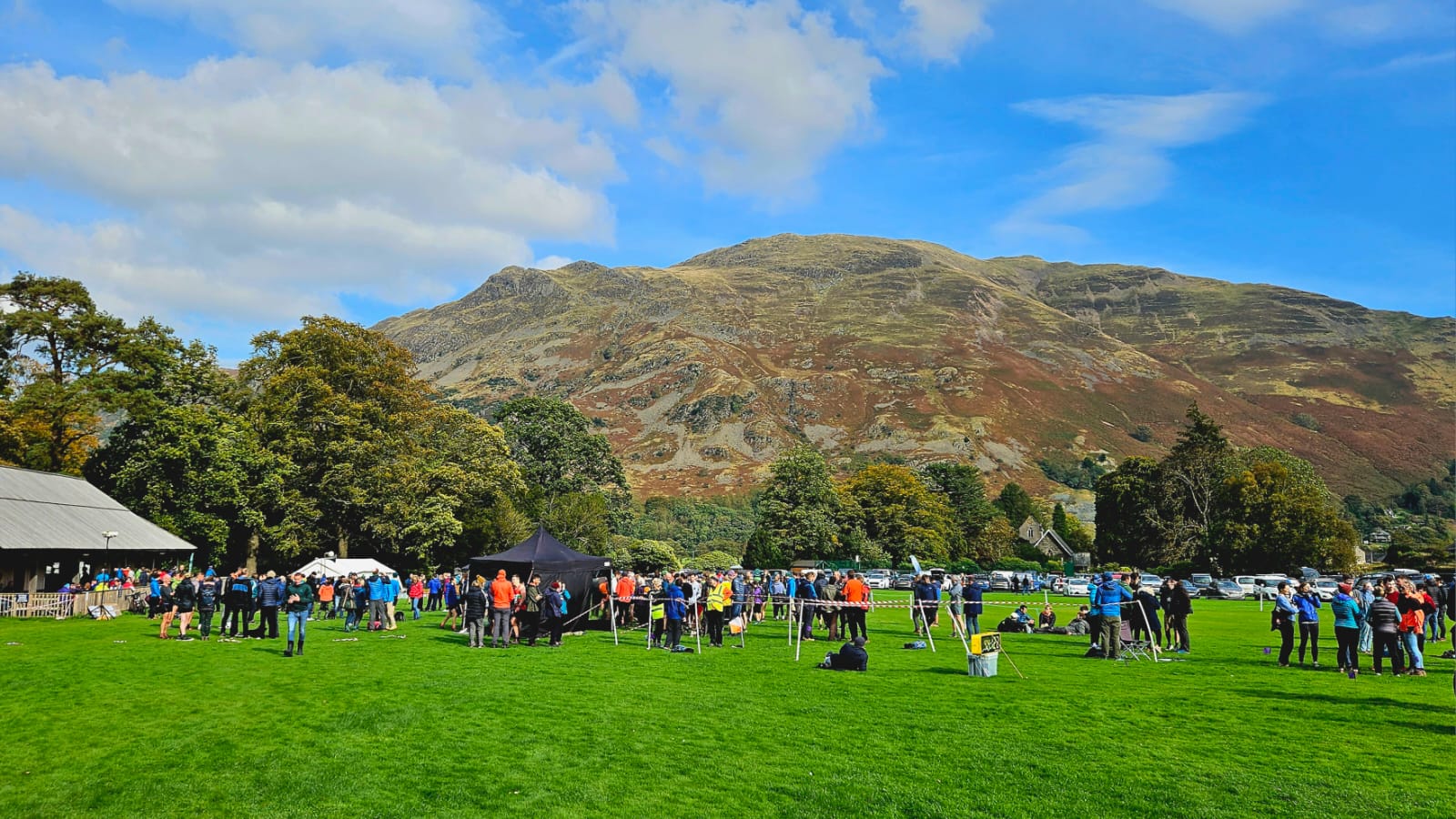
The ‘Hodgson Brothers Mountain Relay’ is a fell running relay race that started life as the ‘Ian Hodgson Mountain Relay’ (see History section for more detail). It is set in the heart of the Lake District Fells, takes place every year on the first weekend in October, and is competed by around 70 teams from across the country, but mainly the North of England. It is the longest-running mountain relay in the country.
The race is a tough one, with 4 legs each throwing up their separate challenges, including hard climbs and steep descents on difficult terrain. The route requires careful navigation, especially in bad weather, so it is imperative that clubs only enter if they are confident that all 8 runners have the navigation & mountain experience to cope with these conditions; it is not a race for novices. The race also represents one of the highlights of the fell running calendar, with keen racing across some magnificent mountain terrain, and is always a great social day out ending with many stories & shared experiences.
Kilburn Kanter 7th Nov 2026
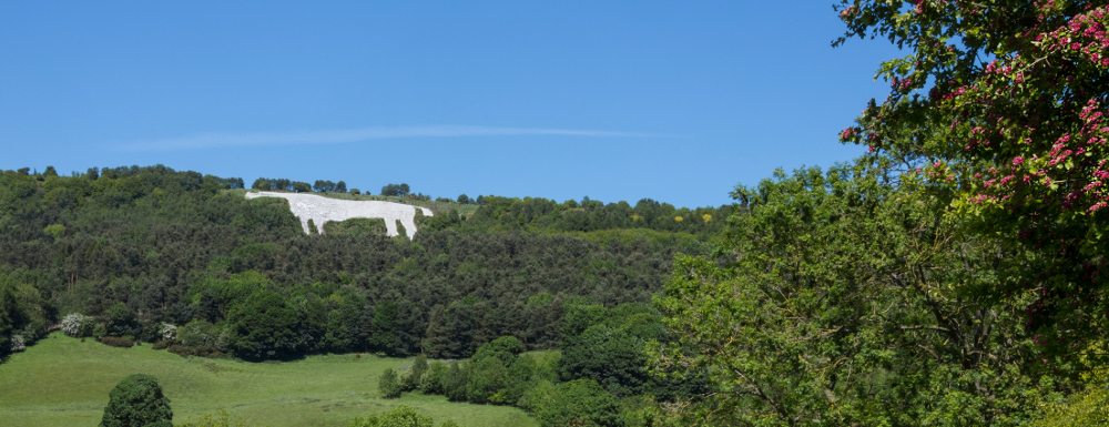
Cleveland RAYNET are looking for operator for the Kilburn Kanter on Saturday 2nd November If would like to attend please contact Cleveland RAYNET
John G8YDC
Lyke Wake Race 11th July 2026
Lyke Wake Race 11th July 2026
Richmond RAYNET
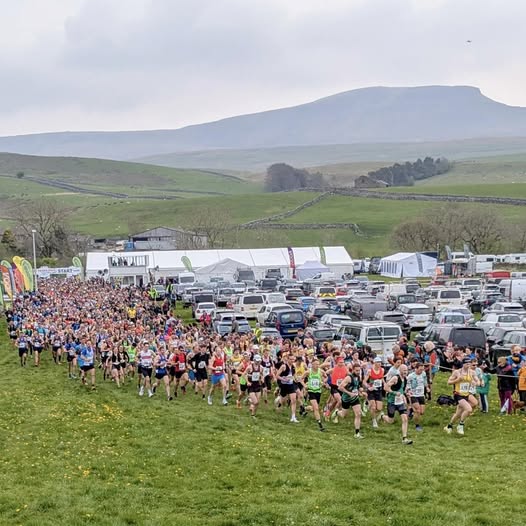
The Challenge is held on a handicap basis based on previous run times over the Lyke Wake route and/or participant’s own estimated times. All participants are expected to be fully aware of the classic Lyke Wake route as the route itself is not marked . The maximum time allowed to complete the event is twelve hours (including the handicap). (Start times, which will be advised with entry confirmation, will be somewhere between approx. 04:00 & 10:00). All participants must be 21 or over on the day to meet the requirements of the Trail Running Association Permit.
The course is a point to point course and we are not able to provide transport to the start or from the finish due to the variable handicap start times and there is limited, remote, parking at the start area. It is therefore advisable to consider your transport solutions carefully.
About the event.
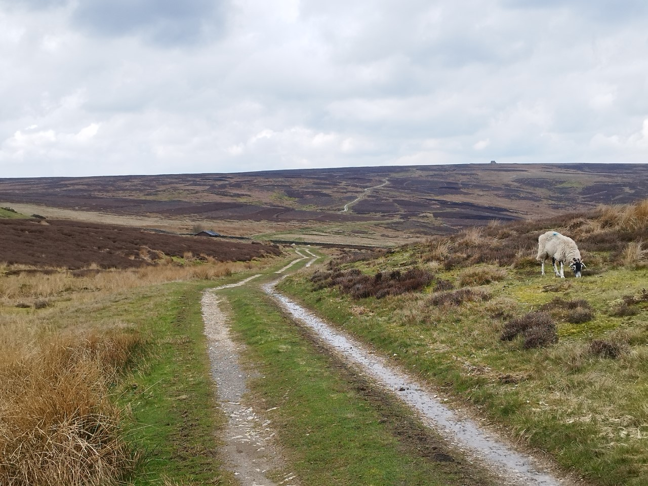
It starts close to Osmotherley (Sheepwash car park, top of Cod Beck reservoir) and the finish is just over 40 miles away at Ravenscar village in the grounds of Raven Hall.
There will be seven checkpoints along the course, each supplying drinks and most with snacks. One checkpoint, the Lion Inn, which is just before halfway, will supply other food such as rice pudding and/or tinned fruit.
the start, finish and checkpoints in between with the what3words references.
Sheepwash – SE467992 browser,fuels,renovated
Carlton Bank – NZ523030 beefed.fitter.inspected
Clay Bank – NZ573033 relishes.correct.trump
Lion Inn – SE679997 gives.lights.stiffly
Hamer – SE744995 tumble.tripped.straying
Stape – SE804983 circus.quicker.sprain
Ellerbeck – SE856982 playfully.grudges.educates
Jugger Howe – NZ945003 actual.bothered.charities
Raven Hall – NZ981017 chins.cabbages.races
Participants should be aware that parts of the route are severe and remote, especially in extreme weather, and therefore mandatory kit must be carried at all time.
Raynet are volunteers who will provide radio communication links between each checkpoint.
Harrogate Rotary Nidderdale Walk 17th May 2026
Harrogate Rotary Nidderdale Walk 17th May 2026
Nidderdale RAYNET Group
Nidderdale Charity Walk & Run
Organised by The Rotary Club of Harrogate in association with Verity Frearson. Supporting Local Charities.
Wensleydale Wander, 11th April 2026
Wensleydale Wander, 11th April
Richmond RAYNET
Come and join us for a friendly and sociable walk in Wensleydale in aid of charities. There is a choice of two circular walks, one a 23 mile challenge and a shorter one of 12 miles, both starting and finishing in Leyburn. There are liquid refreshments at various checkpoints in both walks, while sausage rolls are provided at the halfway point on the longer walk. All walkers receive Soup Roll and Pudding at the finish in Wensleydale School from 12MD to 5pm. Showers are also available. The routes are well sign-posted and marshalled, so no one is likely to get lost!
Both Walks begin at 9.00am in Grove Square, though walkers first gather for registration at Wensleydale School, where car-parking is available. The walk is limited to a maximum 8 hours. Entries prior to the closing date are encouraged. A limited number of entries will be accepted on the day (on the day entries are charged at £25 per entry).
All finishers will receive a certificate.
Wensleydale Wander takes place under rules of the Long Distance Walkers Association (LDWA)
Blubberhouses 25, 22nd March 2026
LDWA Blubberhouses 25 Sun, March 22
Richmond RAYNET
The 2026 Blubberhouses Moor challenge event will take place on Sunday 22 March 2026. Entries are now open at SiEntries https://www.sientries.co.uk/event.php?elid=Y&event_id=16392
A tough 23+ mile route in 9.5 hrs for Walkers and Runners taking in Bland Hill (GR207531) – Swinsty Reservoir – Fewston Reservoir – Thruscross Reservoir – Rocking Hall – Bolton Abbey – Beamsley Beacon – Round Hill – Ellarcarr Pike – Timble – Bland Hill.
Please Note: There will be a cut-off time of 13.45 at CP6 (Ling Farm), any entrant not departing CP6 before that time will be retired from the event. It is a condition of entry that all entrants accept this cut-off.
Includes Certificate, Badge, Some CP refreshments, Hot Meal at finish with Veggie Option.
KARS & KRG Archive Post/pages
Camping Weekend
Add event to calendar


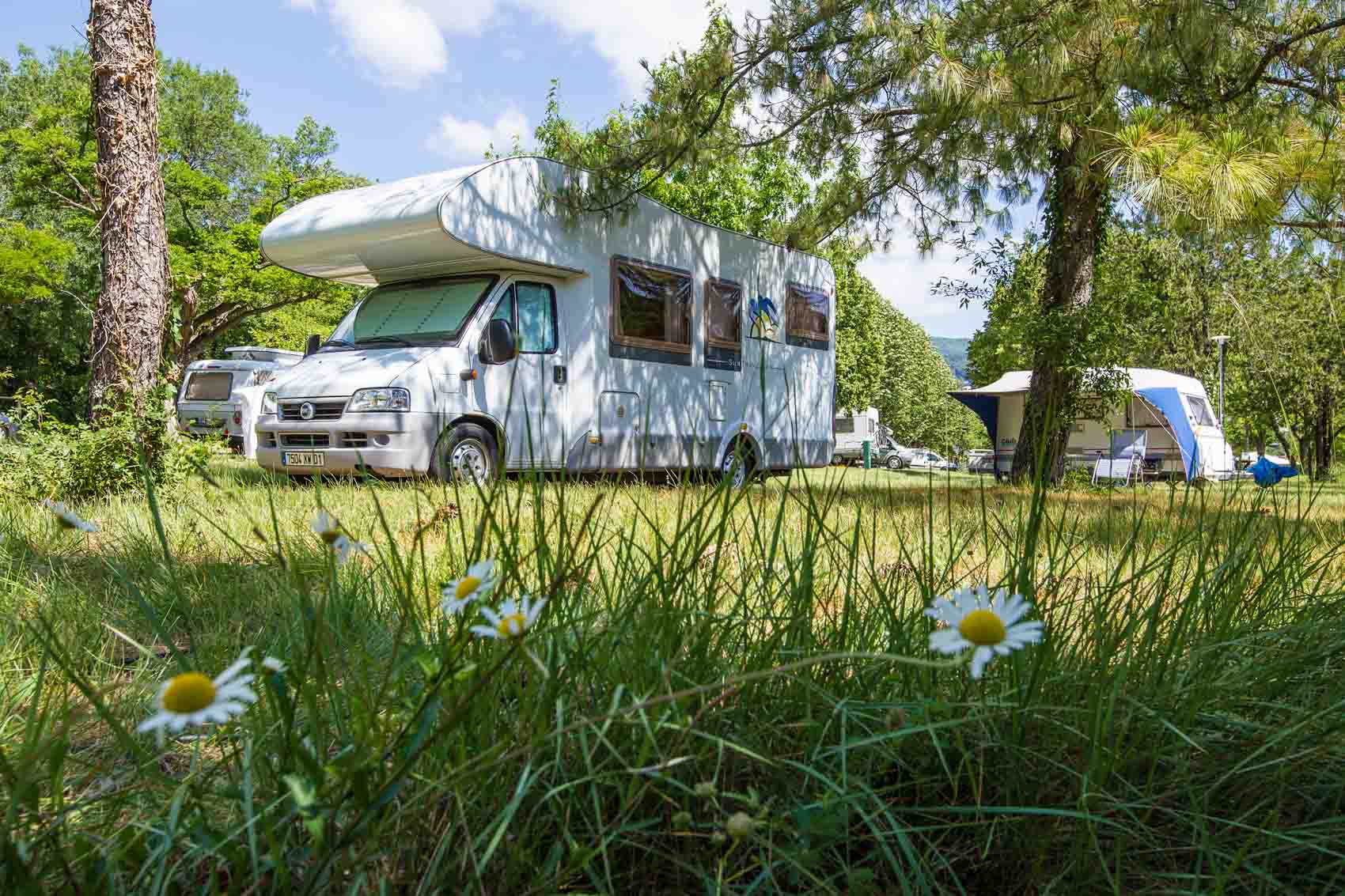 Keighley Amateur Radio Society and Keighley RAYNET Group camping and caravanning weekend on 31st July till the 3rd Argust 2026, at Farm, LowerHeights, Horn Ln, Silsden, Keighley BD20 9HW
KARS & KRG Camping Weekend Members Area
Members and Committee Members or Event Coordinator only
KARS & KRG Scheduled Post/pages
Keighley radio Club & Keighley RAYNET
KARS & KRG Scheduled Post/pages
Draft Post/pages Committee only
KARS & KRG Login
raynet-committee-event-coordinators
Committee

Event Coordinators

24 Hour Callout 033 00 43 00 42
G7HEN ADMIN
Mike G7HEN web page
Testing Page
Checkpoint 2 - Street Gate
Grid Reference - SD 90500 65700
Grid Reference (6 figure) - SD905657
X (Easting) , Y (Northing) - 390500 , 465700
Latitude , Longitude (decimal) - 54.087121 , -2.1467210
Latitude , Longitude (degs, mins, secs) - 54°05′14″N , 002°08′48″W
What3Words : - goodness.paint.intention
Address (near) : - Malham, North Yorkshire, York and North Yorkshire, England, United Kingdom
Grid Reference (6 figure) - SD905657
X (Easting) , Y (Northing) - 390500 , 465700
Latitude , Longitude (decimal) - 54.087121 , -2.1467210
Latitude , Longitude (degs, mins, secs) - 54°05′14″N , 002°08′48″W
What3Words : - goodness.paint.intention
Address (near) : - Malham, North Yorkshire, York and North Yorkshire, England, United Kingdom
Checkpoint 3 - Kilnsey Village Hall
Grid Reference - SD 97600 67500
Grid Reference (6 figure) - SD976675
X (Easting) , Y (Northing) - 397600 , 467500
Latitude , Longitude (decimal) - 54.103382 , -2.0381974
Latitude , Longitude (degs, mins, secs) - 54°06′12″N , 002°02′18″W
What3Words : - galloped.scaffold.trifle
Address (near) : - B6160, Conistone with Kilnsey, Kilnsey, North Yorkshire, York and North Yorkshire, England, BD23 5PW, United Kingdom
Grid Reference (6 figure) - SD976675
X (Easting) , Y (Northing) - 397600 , 467500
Latitude , Longitude (decimal) - 54.103382 , -2.0381974
Latitude , Longitude (degs, mins, secs) - 54°06′12″N , 002°02′18″W
What3Words : - galloped.scaffold.trifle
Address (near) : - B6160, Conistone with Kilnsey, Kilnsey, North Yorkshire, York and North Yorkshire, England, BD23 5PW, United Kingdom
Checkpoint 5 - Lofthouse Village Hall
Grid Reference - SE 10163 73469
Grid Reference (6 figure) - SE101734
X (Easting) , Y (Northing) = 410163 , 473469
Latitude , Longitude (decimal) - 54.156936 , -1.8458718
Latitude , Longitude (degs, mins, secs) - 54°09′25″N , 001°50′45″W
What3Words : - invest.tastings.bronzes
Address (near) : - Lofthouse Memorial Hall, Trapping Hill, Fountains Earth, Lofthouse, North Yorkshire, York and North Yorkshire, England, HG3 5SA, United Kingdom
Postcode (nearest) : - HG3 5SA
Grid Reference (6 figure) - SE101734
X (Easting) , Y (Northing) = 410163 , 473469
Latitude , Longitude (decimal) - 54.156936 , -1.8458718
Latitude , Longitude (degs, mins, secs) - 54°09′25″N , 001°50′45″W
What3Words : - invest.tastings.bronzes
Address (near) : - Lofthouse Memorial Hall, Trapping Hill, Fountains Earth, Lofthouse, North Yorkshire, York and North Yorkshire, England, HG3 5SA, United Kingdom
Postcode (nearest) : - HG3 5SA
Checkpoint 6 - Grewelthorpe Village Hall
Grid Reference - SE 23117 76129
Grid Reference (6 figure) - SE231761
X (Easting) , Y (Northing) - 423117 , 476129
Latitude , Longitude (decimal) - 54.180426 , -1.6473091
Latitude , Longitude (degs, mins, secs) - 54°10′50″N , 001°38′50″W
What3Words : - eyepieces.regret.retain
Address (near) : - Grewelthorpe Village Hall, Main Street, Wapping, Grewelthorpe, North Yorkshire, York and North Yorkshire, England, HG4 3BT, United Kingdom
Postcode (nearest) : - HG4 3BT
Grid Reference (6 figure) - SE231761
X (Easting) , Y (Northing) - 423117 , 476129
Latitude , Longitude (decimal) - 54.180426 , -1.6473091
Latitude , Longitude (degs, mins, secs) - 54°10′50″N , 001°38′50″W
What3Words : - eyepieces.regret.retain
Address (near) : - Grewelthorpe Village Hall, Main Street, Wapping, Grewelthorpe, North Yorkshire, York and North Yorkshire, England, HG4 3BT, United Kingdom
Postcode (nearest) : - HG4 3BT
Checkpoint 7 - West Tanfield Village Hall
Grid Reference - SE 26900 78800
Grid Reference (6 figure) - SE269788
X (Easting) , Y (Northing) - 426900 , 478800
Latitude , Longitude (decimal) - 54.204247 , -1.5891114
Latitude , Longitude (degs, mins, secs) - 54°12′15″N , 001°35′21″W
What3Words : - puff.grub.vocab
Address (near) : - Main Street, West Tanfield, North Yorkshire, York and North Yorkshire, England, HG4 5JQ, United Kingdom
Postcode (nearest) : - HG4 5JQ
Grid Reference (6 figure) - SE269788
X (Easting) , Y (Northing) - 426900 , 478800
Latitude , Longitude (decimal) - 54.204247 , -1.5891114
Latitude , Longitude (degs, mins, secs) - 54°12′15″N , 001°35′21″W
What3Words : - puff.grub.vocab
Address (near) : - Main Street, West Tanfield, North Yorkshire, York and North Yorkshire, England, HG4 5JQ, United Kingdom
Postcode (nearest) : - HG4 5JQ
PM Page
12th November 2026 Committee Meeting
The meeting will take place at 20:30 in The Bronte, Lees La, Keighley BD22 8RA
Reset your Password
Members and Committee Members or Event Coordinator only
KARS & KRG Draft Post/pages
RAYNET Repeater Log
Members and Committee Members or Event Coordinator only
Keighley RAYNET Email Login
This link will expire in 30 day(s) and can only be used 10 times
RAYNET In Case of Emergency (ICE)
Members and Committee Members or Event Coordinator only
RAYNET Risk Assessments
Members and Committee Members or Event Coordinator only
RAYNET Emails Received
Members and Committee Members or Event Coordinator only
Keighley Radio Committee Calendar
Members and Committee Members or Event Coordinator only
RAYNET Committee Calendar
Members and Committee Members or Event Coordinator only
RAYNET Members News
Members and Committee Members or Event Coordinator only